
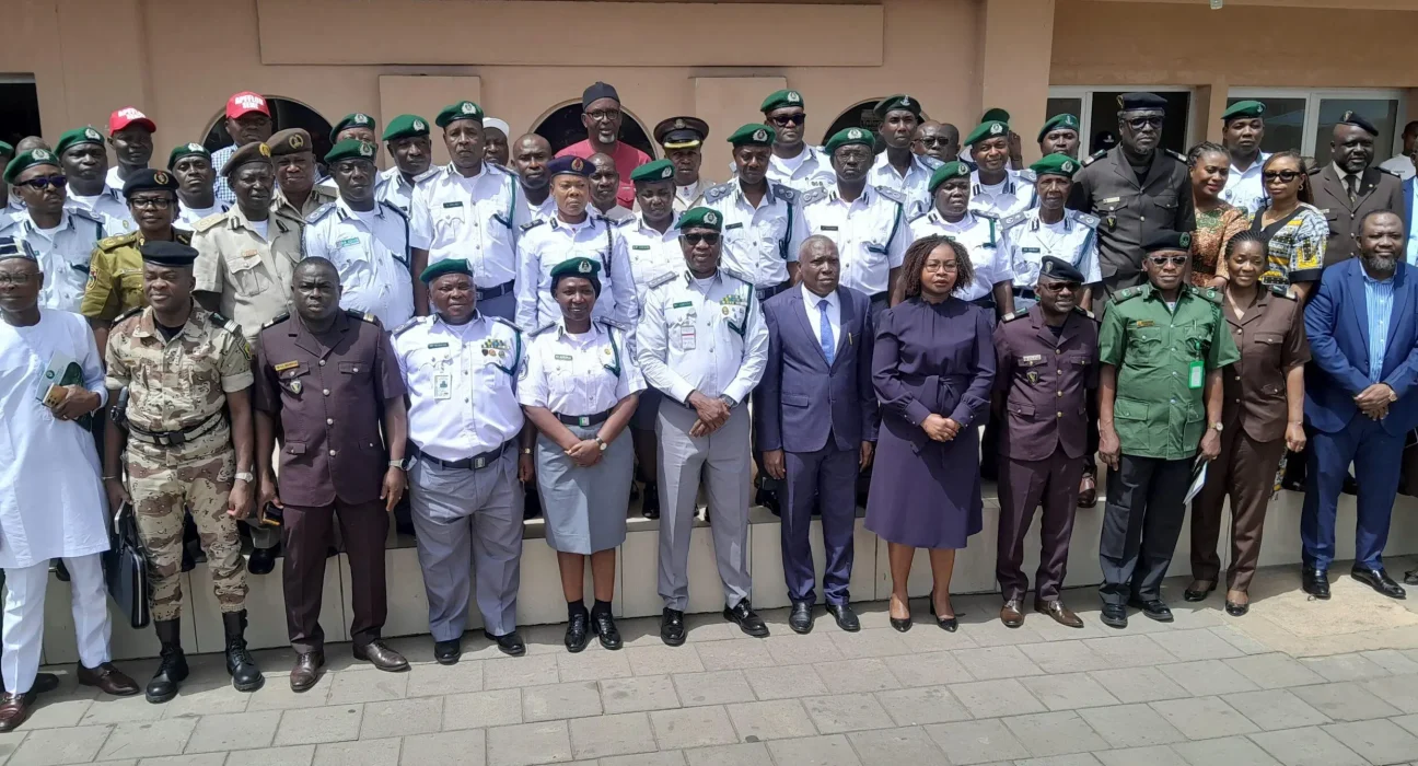
COTONOU, Benin – Nigeria and Benin have completed an eight-day joint customs operation which used geospatial intelligence, drones, risk profiles, and near real-time information exchange to strike smuggling routes along their shared frontier.
Operation GEOCONTROL produced 37 seizures involving narcotics, pharmaceuticals, petroleum products, consumer goods, and other illicit cargo. The World Customs Organization described the mission as its first operational deployment with geospatial intelligence serving as a core customs enforcement tool. The wording matters. Nigeria and Benin have conducted intelligence-led operations before. GEOCONTROL marked the first WCO-led field mission built around geospatial intelligence.
Customs officers from both countries worked from one shared operational picture. Teams mapped high-risk zones, identified suspected smuggling tracks, watched official crossings, and directed field units toward selected targets. Officers used the WCO Geoportal, Geographic Information System applications, drones, secure CENcomm communication channels, risk profiling, and field reports. Near real-time exchange helped both sides act before smugglers shifted goods across another route.
This method attacks a long-standing border weakness. Smuggling groups study patrol routines. Drivers learn which checkpoints operate at night. Brokers watch shift changes. Criminal networks use footpaths, waterways, farms, villages, and informal tracks beyond official gates. Static roadblocks often catch small traders while organised operators move around them.
Geospatial intelligence changes the starting point. Officers no longer wait beside one road and hope contraband arrives. Analysts combine location data, past seizures, movement patterns, surveillance, local reports, and route changes. Field teams then concentrate personnel where risk appears highest. Drones expand visibility across terrain which patrol vehicles struggle to reach.
WCO Secretary General Ian Saunders said Benin and Nigeria had “showcased the tangible benefits of integrating innovative technologies and WCO-developed tools into operational practice.” He added cross-border and inter-agency work helps authorities confront complex security threats and disrupt illicit trade networks.
The operation followed a WCO Master Trainer Programme on geospatial intelligence for West Africa. Customs officers from Benin, Côte d’Ivoire, Ghana, Nigeria, and Togo joined the training. GEOCONTROL tested whether classroom knowledge would survive field pressure. Thirty-seven seizures suggest trained officers converted mapping and analysis into action.
Still, authorities have left major questions unanswered. The WCO did not publish seizure quantities, estimated values, arrest totals, suspect nationalities, prosecution plans, or precise locations. Officials also listed arms, ammunition, counterfeit goods, petroleum, pharmaceuticals, narcotics, and protected wildlife products among priority threats, but the announcement did not state whether every category appeared among seized goods.
Transparency matters. A seizure count alone gives an incomplete picture. One intercepted fuel container and one major narcotics shipment both count as single seizures, despite huge differences in value, public danger, and criminal reach. Nigeria and Benin should release a joint results table without exposing sensitive methods. Citizens need quantities, values, case numbers, arrests, court referrals, and agencies responsible for follow-up.
The border carries legal trade alongside crime. Thousands of traders, transporters, travellers, and businesses depend on the wider Abidjan-Lagos corridor. Aggressive enforcement without clear targeting risks delays, extortion, duplicated inspections, and higher food or transport costs. Intelligence should reduce random stops, not create another layer of bureaucracy.
Benin and Nigeria already started linking customs systems before GEOCONTROL. On 19/05/2025, both administrations launched SIGMAT at the Sèmè-Kraké crossing. The system exchanges transit data electronically and in real time. Benin Customs said the platform aims to reduce border delays, remove repeated controls, improve transparency, strengthen security, and fight cross-border fraud.
SIGMAT tracks declared cargo. GEOCONTROL searches for movement outside declared channels. Together, both systems form a stronger model. Digital transit records expose suspicious changes. Geospatial tools reveal routes around official posts. Drones observe selected areas. Secure communications connect officers on both sides. Joint teams prevent suspects from exploiting national boundaries between separate agencies.
Nigeria also strengthened domestic cooperation in April. The Nigeria Customs Service and National Drug Law Enforcement Agency agreed to share intelligence through a secure platform and deploy joint task forces at seaports, airports, and land borders. Both agencies also created a standing committee to resolve disputes and reduce overlapping duties.
Such agreements matter because smugglers profit from institutional rivalry. Customs sees undeclared goods. Drug officers investigate narcotics. Immigration handles movement of people. Police pursue criminal networks. Environmental agencies protect endangered species. Financial investigators trace proceeds. When each body guards information, traffickers pass through gaps between mandates.
Regional cooperation also protects revenue. Smuggled petroleum undermines lawful dealers and tax collection. Counterfeit medicines threaten patients and licensed pharmacies. Unregistered consumer goods undercut compliant businesses. Wildlife trafficking damages ecosystems. Arms shipments feed violence. Narcotics finance organised crime and destroy families. Every border seizure therefore carries economic, health, security, and social consequences.
Technology brings its own risks. Officials need clear rules for drone flights, data retention, access controls, civilian privacy, and evidence handling. A map built from poor information directs officers toward innocent communities. Leaked operational data helps smugglers change routes. Expensive equipment without maintenance soon becomes useless. Governments must budget for batteries, software, secure servers, repairs, training, and independent audits.
Customs leaders should also measure displacement. Pressure on one route often pushes smuggling toward another crossing, river, coastal path, or neighbouring state. A successful eight-day mission does not prove permanent disruption. Nigeria and Benin need follow-up operations, rotating tactics, financial investigations, prosecutions, and cooperation with Togo, Ghana, Niger, and wider ECOWAS structures.
The strongest result would extend beyond seized cargo. Investigators should identify financiers, warehouse owners, transport coordinators, corrupt officials, document forgers, and wholesale buyers. Arresting low-level drivers while organisers keep their profits leaves the network intact. Intelligence work should follow money and communications from the border toward command structures.
GEOCONTROL offers West Africa a serious lesson. Borders become safer when neighbours share information instead of hiding behind sovereignty. Modern customs work needs analysts as much as road patrols. Drones and maps do not replace honest officers. They help honest officers use time, vehicles, and personnel with greater precision.
Nigeria and Benin have proved joint data-led enforcement works in the field. Their next duty involves publishing fuller results, prosecuting cases, protecting lawful traders, and repeating operations without turning border communities into permanent suspects.
Smugglers adapt quickly. Customs authorities must learn faster.